Baton Rouge Flood Threat This Weekend: What to Know
The National Weather Service New Orleans office has posted a confirmed 'Flash Flooding Potential This Weekend' alert for the October 3–4, 2026 period, with multiple rounds of showers and thunderstorms expected and the highest flash flood potential Saturday morning through Monday morning. An active Flood Warning is in effect for the Amite River at Denham Springs — monitor NWS and local news closely for updates, as conditions can change rapidly. The Comite River Diversion Canal, the region's largest active flood control project, was reported at 67% complete as of August 2026 with a projected 2028 finish, meaning its floodgates are not yet operational. For buyers, a property's FEMA flood zone designation, elevation certificate, and flood insurance cost remain the most actionable data points right now.
Baton Rouge Flood Threat Outlook for October 3–4
If you are watching the Baton Rouge flood threat this weekend, the starting point is always the National Weather Service office in New Orleans (weather.gov/lix), which issues watches, warnings, and advisories for Southeast Louisiana in real time. As of the evening of October 2, 2026, the NWS New Orleans office had posted a confirmed 'Flash Flooding Potential This Weekend' alert, noting that multiple rounds of showers and thunderstorms will impact the region Friday through Sunday, with the highest potential for flash flooding Saturday morning through Monday morning.
The WBRZ weather team's Friday forecast confirmed rain coverage of approximately 90% on Saturday and 80% on Sunday across the Capital Area, with a baseline of 1 to 4 inches of rain expected through the weekend. Isolated intense rainfall rates could top 4 inches per hour in localized thunderstorm cells, which can overwhelm street storm drains and ditches quickly, leading to water ponding on roads and localized flash flooding in low-lying spots or underpasses. An active Flood Warning is in effect for the Amite River at Denham Springs, with the river forecast to crest at flood stage — a direct concern for Livingston Parish communities along that corridor. Check WAFB, WBRZ, and weather.gov/lix for the latest river stage and warning status, as these can be updated multiple times per day during active weather events.
Greater Baton Rouge sits within a watershed fed by the Comite, Amite, and Mississippi Rivers, and rainfall totals that seem modest on a regional map can produce localized street flooding within hours, particularly in low-lying neighborhoods or areas with undersized drainage infrastructure. The NOAA river gauge at Baton Rouge (water.noaa.gov/gauges/btrl1) provides real-time stage readings for the Mississippi River if you want to track conditions independently.
How Floodgate Projects Affect Greater Baton Rouge Properties
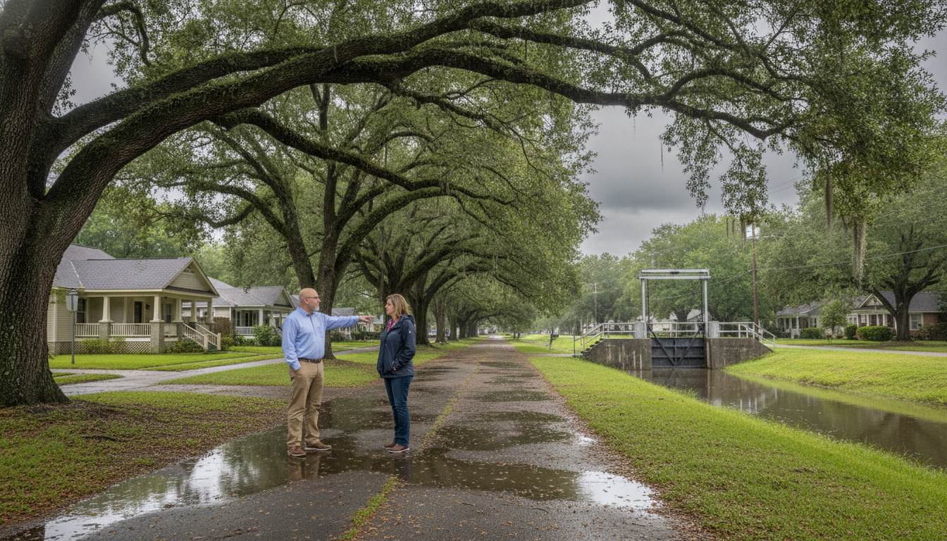
The most consequential flood infrastructure project in Greater Baton Rouge right now is the Comite River Diversion Canal, a joint federal-state effort managed by the U.S. Army Corps of Engineers. The project is designed to divert floodwaters from the Comite River into the Mississippi River through a 12-mile channel, reducing overflow into the Amite River and protecting communities in East Baton Rouge and Livingston Parishes. According to reporting from August 2026, the project was approximately 67% complete, all 23 contracts had been awarded, and multiple construction segments were actively underway. The most recent reporting as of late September 2026 pointed to a spring 2028 target for completion, though the project has a history of timeline adjustments — verify the current schedule directly with the U.S. Army Corps of Engineers (mvn.usace.army.mil) or the Louisiana DOTD project page. The project's total cost has been reported at more than $800 million in recent official sources.
What this means practically: the floodgates are not yet operational, and the flood risk reduction the project is designed to deliver — including the potential removal of thousands of structures from the 100-year floodplain — has not yet materialized for affected neighborhoods. Buyers evaluating properties along the Amite River corridor in Livingston Parish or in areas of northern East Baton Rouge Parish should understand that the project's benefits are still years away. Once complete, the canal is intended to reduce flood risk for a large portion of the region — with the project's goal described as protecting approximately 700,000 area residents — which could eventually influence FEMA flood map designations, flood insurance premiums, and property values. But those downstream effects depend on the project finishing on schedule and on FEMA subsequently updating its maps, a separate process with its own timeline.
A companion project, the East Baton Rouge Flood Risk Reduction Project, involves drainage improvements across approximately 66 miles of drainage ways in five sub-basins, per city-parish official announcements (the USACE project page describes the current construction plan as improvements to 50 miles of channels — check mvn.usace.army.mil for the current scope). Construction on the Bayou Fountain, Lower Jones Creek, and Ward Creek portions was reported as complete, with remaining work ongoing.
Practical Preparation for Buyers and Homeowners This Weekend
With the NWS New Orleans office confirming flash flooding potential for this weekend, the practical steps for homeowners and buyers are the same whether or not a particular storm produces significant flooding — and they are worth reviewing now.
First, know your flood zone. FEMA's Flood Map Service Center (msc.fema.gov) and the LSU AgCenter's Louisiana flood map tool allow you to look up a specific address and identify its flood zone designation. Properties in Zone AE carry mandatory flood insurance requirements for federally backed mortgages. Properties in Zone X — the minimal-risk designation — are not required to carry flood insurance, but the 2016 flood inundated thousands of Zone X homes across the region, a reminder that the map reflects statistical probability, not a guarantee.
Second, flood insurance is separate from homeowner's insurance and must be in place before a flood event to be valid for that event. If you are under contract on a property or recently closed, confirm your flood policy is active. Buyers should obtain actual flood insurance quotes — not estimates — before making an offer on any property in Greater Baton Rouge, because premiums vary significantly by zone, elevation, and structure type.
Third, if you own property in a low-lying area or near a drainage canal, review your emergency plan now: know your evacuation route, keep important documents accessible, and monitor local emergency management channels for any shelter-in-place or road closure guidance during active weather events. With the Amite River at Denham Springs under an active Flood Warning and additional rainfall forecast through the weekend, Livingston Parish residents in particular should stay current with local emergency management updates.
Questions, Documents, and Professionals to Consider
For buyers, the Baton Rouge flood threat is not just a weekend weather question — it is a due diligence category that deserves the same attention as the inspection report. Here are the key items to work through with your agent and the appropriate licensed professionals.
**Elevation Certificate:** Ask whether an elevation certificate exists for the property. This document, prepared by a licensed surveyor or engineer, records the structure's elevation relative to the Base Flood Elevation (BFE). It is often required to obtain accurate flood insurance quotes and can significantly affect premium calculations. East Baton Rouge Parish also uses Community Defined Flood Elevations (CDFE) as a supplement to FEMA BFEs for new construction, with the higher elevation controlling — a detail worth discussing with the parish's development office if you are evaluating new builds.
**Flood Insurance Quote:** Contact a licensed insurance agent who writes National Flood Insurance Program (NFIP) policies or private flood coverage. Premiums depend on zone, elevation, structure type, and coverage amount. Do not rely on the seller's current premium as a guide — rates can change at transfer.
**Flood History:** Ask your agent and the seller about past flood events affecting the property. Louisiana's seller disclosure form addresses flood history, but your agent can help you understand what questions to ask and what documentation to request.
**Comite Canal Project Status:** If a property's marketing materials suggest it will benefit from the Comite River Diversion Canal, ask for specifics. The project is not yet complete, FEMA map revisions have not yet occurred, and any insurance premium reductions tied to the project are speculative until those steps are finalized. Verify current project status directly with the U.S. Army Corps of Engineers (mvn.usace.army.mil) or the Louisiana DOTD project page.
**Professionals to involve:** Licensed insurance agent (flood coverage), real estate attorney (disclosure review and contract contingencies), licensed surveyor or engineer (elevation certificate), and your lender (flood insurance requirements for your specific loan type).

Baton Rouge Home Seller FAQ
Is there a flood watch or warning for Baton Rouge this weekend (October 3–4, 2026)?
Yes — as of the evening of October 2, 2026, the National Weather Service New Orleans office had posted a confirmed 'Flash Flooding Potential This Weekend' alert, with multiple rounds of showers and thunderstorms expected Friday through Sunday and the highest flash flood potential Saturday morning through Monday morning. An active Flood Warning is also in effect for the Amite River at Denham Springs, with the river forecast to crest at flood stage — a direct concern for Livingston Parish communities. Conditions and official watch/warning status can change rapidly. For the most current information, check weather.gov/lix or tune to local news.
Are the Comite River Diversion Canal floodgates open or closed right now?
The Comite River Diversion Canal does not yet have operational floodgates — the diversion control structure is still under construction. As of August 2026, the project was approximately 67% complete. The most recent reporting as of late September 2026 pointed to a 2028 completion target, though the project has a history of timeline adjustments. Until construction is finished and the control structure is operational, the canal cannot divert floodwaters. For the most current project status, check the U.S. Army Corps of Engineers project page at mvn.usace.army.mil.
How do I find out what FEMA flood zone my property is in?
You can look up any property's FEMA flood zone designation using FEMA's Flood Map Service Center at msc.fema.gov by entering the property address. The LSU AgCenter also maintains a Louisiana-specific flood map tool. Your real estate agent can help you locate and interpret the map, but for a binding determination — especially for lending or insurance purposes — consult a licensed surveyor, your lender, or a licensed insurance agent who can order an official flood zone determination.
Does a Zone X designation mean my property won't flood?
No. Zone X indicates a lower statistical probability of flooding compared to high-risk zones like AE, but it does not mean a property is immune to flooding. The August 2016 flood in Greater Baton Rouge inundated thousands of homes that carried Zone X designations. Flood insurance is not required for Zone X properties with federally backed mortgages, but it is available and worth discussing with a licensed insurance agent given the region's flood history.
Will the Comite River Diversion Canal lower flood insurance premiums for nearby properties?
Potentially, but not immediately and not automatically. Once the project is complete — currently projected for 2028, though timelines have shifted before — FEMA would need to revise its flood maps to reflect the reduced risk in protected areas. Only after those map revisions are finalized and adopted would affected properties potentially see changes to their flood zone designations and associated insurance requirements. Any marketing claim that a property already benefits from the canal's flood protection should be verified against current project and FEMA map status.
Sources
- NWS New Orleans — Watches, Warnings & Advisories (Flash Flooding Potential This Weekend)
- WBRZ — Friday PM Forecast: Wet and Humid Weather Expected Through Weekend
- WBRZ — Comite Diversion Canal 67% Complete, 2028 Finish
- U.S. Army Corps of Engineers — Comite River Diversion Project
- Louisiana DOTD — Comite River Diversion Canal Project
- U.S. Army Corps of Engineers — East Baton Rouge Flood Risk Reduction
- Amite River Basin Commission — Bayou Manchac & Upper Amite Projects
- Livingston Parish News — Comite Diversion Construction Update
- NOAA River Gauge — Mississippi River at Baton Rouge
- FEMA Flood Map Service Center
- LSU AgCenter Louisiana Flood Maps